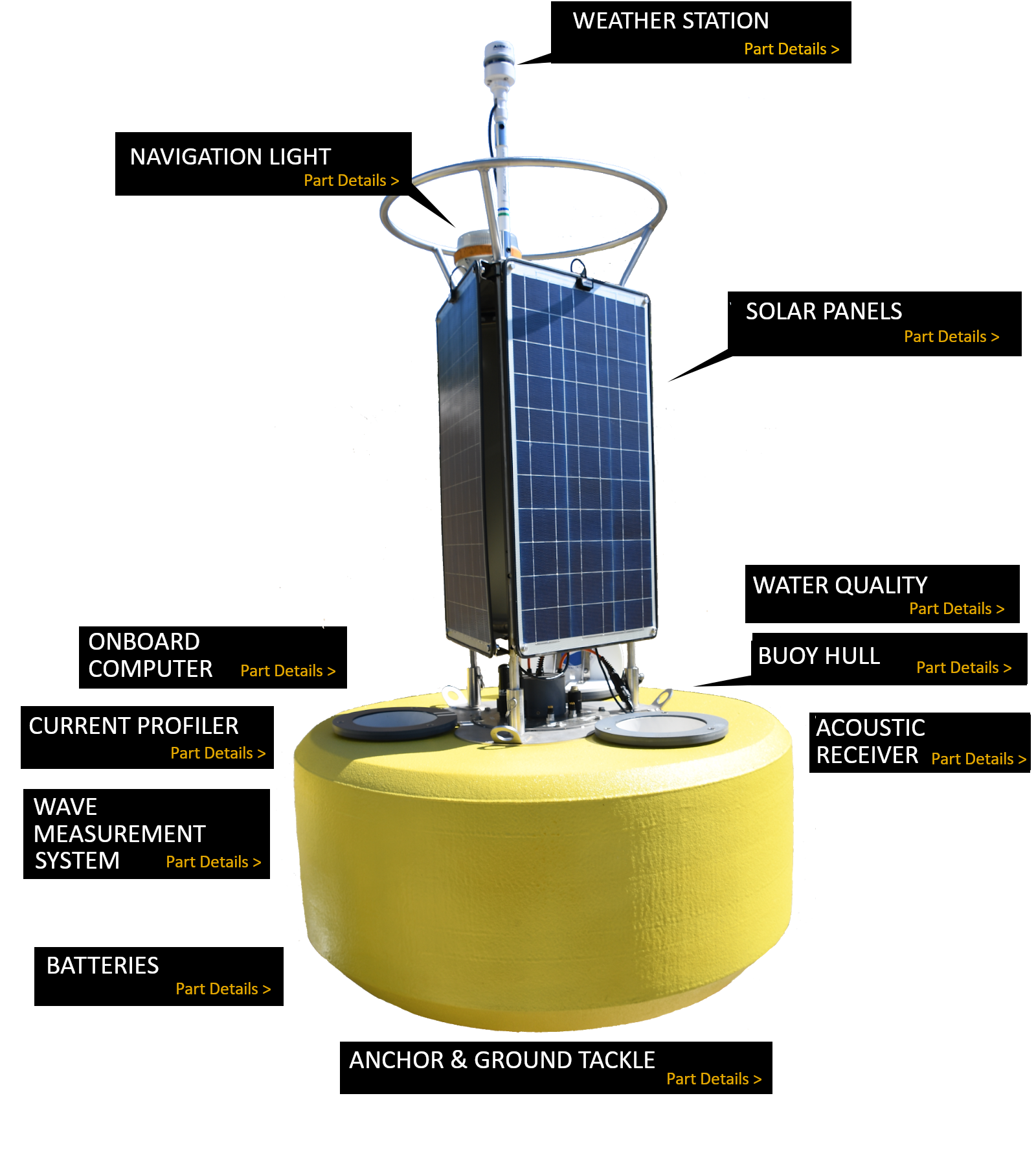


Weather Station
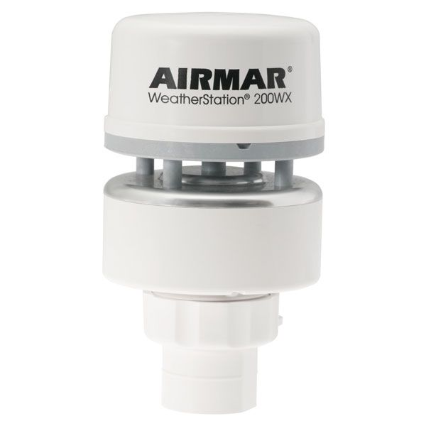
The Airmar 200WX-IPX7 measures wind speed, wind gust, wind direction, and air temperature. It also has an integrated GPS receiver that tracks buoy position and a barometer that measures air pressure.
Solar Panels
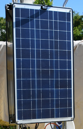
The solar panels provide power for the buoy’s sensor and transmission capabilities. There are three 57-watt solar panels on each buoy.
Water Quality
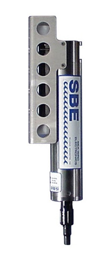
CBIBS buoys use sensors to monitor water-quality parameters including water temperature, salinity, dissolved oxygen, turbidity, and chlorophyll-a. Salinity and temperature are the key measurements we report; other parameters are also measured at some locations. CBIBS tracks these parameters at 0.5 meters below the water’s surface.
Buoy Hull
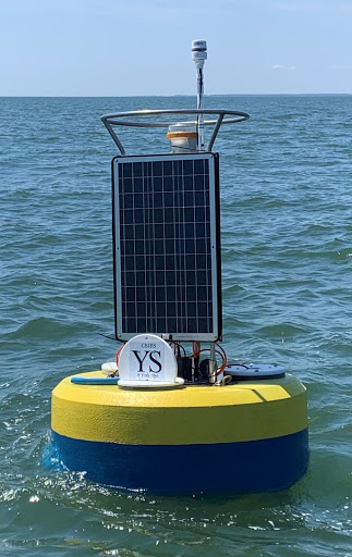
Each NexSens buoy is about 6 feet tall. They weigh less than 500 pounds and are made out of cross-linked polyethylene foam with polyurea coating and stainless steel deck and solar array components.
Acoustic Receiver

Acoustic receivers: Innovasea VR2W data-logging computers attached to the bottom of the buoy “listen” for tagged fish. When a 69 kHz signal is identified, the transmitter tag's unique ID code is saved with the date and time. The data from any single receiver provides a record of each visit to that location by a tagged fish. The data are uploaded to the Mid-Atlantic Acoustic Telemetry Observation System when the receivers are retrieved from the field.
Anchor & Ground Tackle
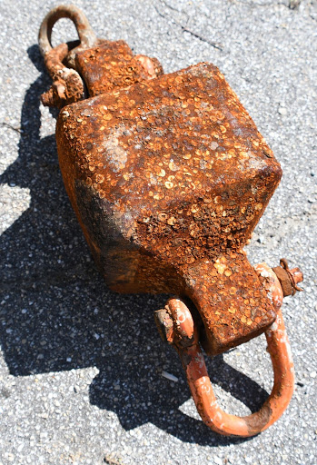
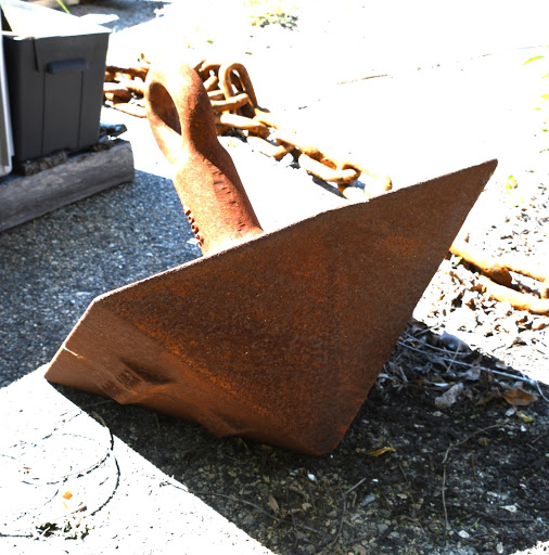
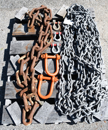
Each CBIBS buoy is moored to the Bay bottom by way of a single-point mooring setup including ballast weight, swivels, and ½” and 1" mooring chain connected to a pyramid-style steel anchor. The chain length is approximately 2.5 times the water depth at the buoy's location.
Batteries
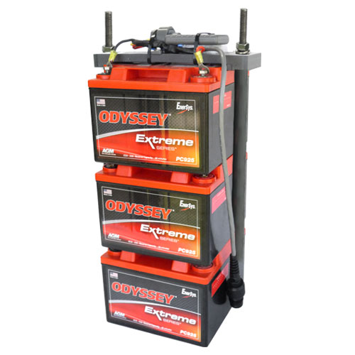
Inside the buoy’s hull are three 28 A-h 12-volt batteries that run the buoy systems via a wiring harness that includes a solar charger.
Wave Measurement System
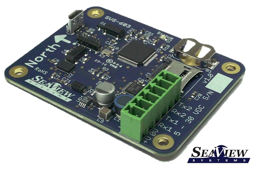
The SeaView SVS-603 is a highly accurate wave sensor that reports wave height, wave period, wave direction, and more via RS-232 and logs wave data, energy spectra, acceleration, and more.
Current Profiler
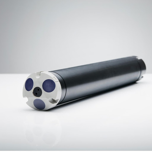
The profiler provides current speed and current direction at one-meter levels from the surface to the bottom. The current as reported on the CBIBS website and database is an average of the upper five meters. The CBIBS standard instrument is a NORTEK AquaDopp. It measures currents by analyzing acoustic (1 mHz frequency) reflections from the moving water below the instrument over a five-minute period ten times per hour.
Onboard Computer
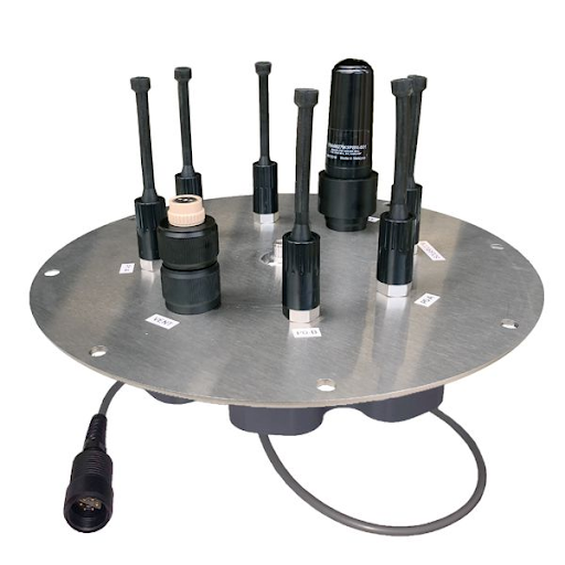
The NexSens X2-CB data logger compiles processed data from all of the sensors, packages it into an XML file, and sends it back to a shoreside database via FTP every six minutes.
Navigation Light
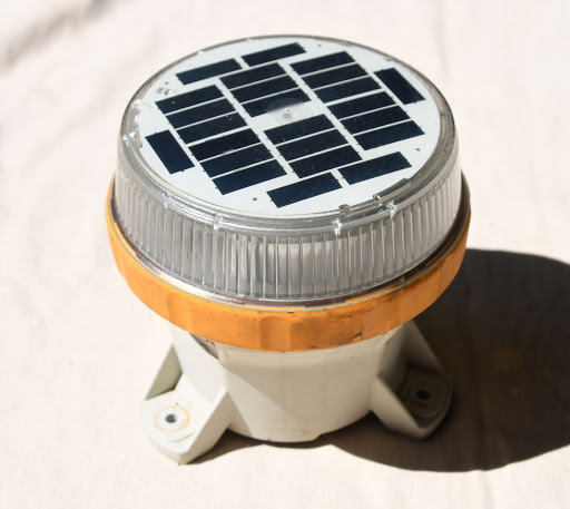
The navigation light is an amber LED light that flashes once every four seconds. Navigation lights have battery and solar charging systems independent from the buoy. The light makes the buoy more visible for nighttime boaters, and is shown on the charts as "Fl 4 sec Y."
Wind Speed
Wind speed describes how fast the air is moving past a certain point at a certain time. CBIBS tracks this as a running mean over the previous six minutes. CBIBS measures wind speed in meters per second (m/s), which is converted into other units for our app and website—usually knots (nautical miles per hour). Wind speed affects sea state (calm or wavy) as well as the mixing of water in the Bay.
Go back to Previous PageWind Gust
Wind gust describes the fastest wind speed recorded. At CBIBS buoys, this is the highest five-second running mean recorded during the previous six-minute period. CBIBS measures wind gust in meters per second (m/s), which is converted into other units for our app and website—usually knots (nautical miles per hour).
Go back to Previous PageWind Direction
Wind direction describes the direction on a compass from which the wind comes. For example, a wind direction reading of 90° indicates that the wind is coming from the east. This is an average over the previous six minutes.
Go back to Previous PageAir Temperature
Temperature is how hot or cold something is as measured on a definite scale. CBIBS buoys measure air temperature in degrees Celsius and convert this measurement into degrees Fahrenheit. Technically, heat is an indicator of the kinetic energy, or energy of motion, of the gasses that make up the air. As gas molecules move more quickly, air temperature increases. CBIBS buoys report air temperature as a six-minute average.
Go back to Previous PageWater Temperature
Temperature is how hot or cold something is as measured on a definite scale. CBIBS buoys measure water temperature in degrees Celsius and convert this measurement into degrees Fahrenheit. CBIBS buoys report temperature as a six-minute average.
Go back to Previous PageSalinity
Salinity is the concentration of salt in the water. Technically, CBIBS buoys measure specific conductance, and then applying a linear formula lets us report salinity in practical salinity units—PSUs. (Salinity is sometimes reported in parts per thousand—ppt.) Salinity levels are a function of the mixing of ocean waters, which contain approximately 32 ppt (parts per thousand) salinity, with fresh water from the Bay’s tributaries (< 1 ppt salinity). This is reported as an hourly average. Salinity plays a big role in determining where the Bay’s plants and animals live, and in some cases when the animals reproduce or migrate. In any given location, salinity can vary greatly depending upon river flow—low during high flows and high during droughts. Most of the Bay’s living resources can adapt to these large swings in salinity, but extreme floods or droughts can lead to stressful conditions.
Go back to Previous PageDissolved Oxygen
The amount of oxygen dissolved in Bay waters is a critical measure of habitat quality; without oxygen, living resources die. Dissolved oxygen (DO) is measured in milligrams per liter (mg/l). This is reported as an hourly average. (DO is not measured at all CBIBS locations.)
Go back to Previous PageTurbidity
Turbidity describes how clear the water is. This is measured using a transmissometer, which records turbidity values in nephelometric turbidity units (NTUs). This is reported as an hourly average. (Turbidity is not measured at all CBIBS locations.)
Go back to Previous PageChlorophyll-A
Chlorophyll is the main chemical responsible for photosynthesis, the process by which sunlight is converted into food energy by plants. To track chlorophyll levels, the CBIBS buoys measure the amount of algae in the water in micrograms per liter (ug/l). This is reported as an hourly average. (Chlorophyll-a is not measured at all CBIBS locations.)
Go back to Previous PageWave Height
Significant wave height is the average height—from crest to trough—of the highest portion of waves recorded in a given monitoring period at a buoy. Wave measurements are reported by CBIBS buoys every six minutes.
Go back to Previous PageWave Period
Significant wave period is the time that passes between two successive wave crests that move past a buoy. Wave measurements are reported by CBIBS buoys every six minutes.
Go back to Previous PageWave Direction
CBIBS reports the direction the waves are going toward. For example, a wave direction reading of 90° indicates that the waves are running from west to east. This is reported as a six-minute average.
Go back to Previous PageCurrent Speed
Current is a movement of water; current speed is the speed of this movement. CBIBS buoys measure current speed in nautical miles per hour, also known as knots. This is reported as a six-minute average.
Go back to Previous PageCurrent Direction
Current direction is the direction on a compass toward which water is moving. For example, a current direction reading of 90° indicates that the current is running toward the east. This is reported as a six-minute average. Current direction is affected by tides, wind, and the shape of the water body.
Go back to Previous Page

